INSIGHTS
Mapping out Ireland's New Wave of Offshore Wind
An advanced geospatial framework from University College Cork fast-tracks floating wind approvals by resolving maritime spatial conflicts
8 Jun 2026
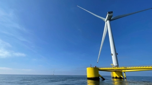
A new ocean mapping framework developed by researchers at University College Cork aims to accelerate floating offshore wind development off the western coast of Ireland. Launched this May, the spatial modeling system is designed to address coastal regulatory gridlock by simultaneously mapping environmental data, bathymetric depths, and community feedback. The initiative arrives as Ireland seeks to advance its renewable energy infrastructure along a highly contested coastline.
While deep-water wind resources along the Atlantic shelf attract commercial interest, energy developers routinely face regulatory pushback from fishing fleets and environmental conservation groups. Balancing these competing maritime interests has traditionally required lengthy planning cycles. The new software evaluates ocean depths, wind velocities, and subsea geology across 26 distinct coastal sectors to isolate prospective turbine coordinates. According to project data, this predictive approach can shorten early-stage site development timelines by identifying engineering constraints before major private capital expenditure begins.
The digital framework attempts to resolve long-standing maritime territorial disputes by providing standardized spatial clarity to all stakeholders. By evaluating conflicts objectively, the system establishes a shared baseline for developers, local communities, and conservationists alike.
Irish maritime planning authorities are beginning to utilize these maps to inform regional licensing guidelines, optimize grid connections, and manage investment risks. Designed to mitigate post-consent legal litigation, the software provides a data-driven framework intended to protect traditional marine industries while expanding domestic energy infrastructure. Officials suggest the approach could reduce the friction that frequently stalls coastal infrastructure projects.
Balancing large-scale industrial growth with marine conservation targets remains a complex challenge for the region. However, proponents suggest that the system could establish a repeatable regulatory model for future deep-water leasing rounds across European maritime territories. The long-term efficacy of the framework will likely depend on continued data fidelity and multi-industry cooperation, factors that will shape Irish energy policy in the years ahead.
Related News


SUBSCRIBE FOR UPDATES
By submitting, you agree to receive email communications from the event organizers, including upcoming promotions and discounted tickets, news, and access to related events.